
Binn Bhan [Maumturkmore]
Good walks are even better shared.
Overview
Binn Bhan [Maumturkmore]
Overview
Binn Bhan, also known as Maumturkmore, stands proudly in the Maumturk mountain range with an elevation of 682 meters. Its rocky hilltops and gentle slopes create a picturesque landscape that attracts hikers and outdoor lovers alike.
Geology
The mountain is primarily composed of quartzite and schist layers, showcasing a rich geological history that dates back millions of years. This rugged terrain not only adds to the charm but also presents unique hiking challenges, especially in certain weather conditions.
Routes
The most popular route is the Binn Bhan Loop starting from the Lough Nafooey Car Park. This 12 km loop offers stunning views and takes about 4.5 hours to complete at a moderate difficulty level. The ascent is gradual, but be prepared for a few rocky patches along the way.
Summit Features
At the summit, you're greeted by a well-constructed cairn—an ideal spot to catch your breath while soaking in the views. Don't forget to take a selfie; your friends need to know you really did climb this beauty!
Terrain Type
Expect a mix of rocky outcrops, grassy meadows, and patches of bog, especially if you’re hiking after rains. Good boots are essential here—your feet will thank you later!
Views
The panoramic views from the summit are nothing short of spectacular. You can see Lough Corrib glistening in the distance, interspersed with the remarkable peaks of the Twelve Bens. Late spring to early autumn is the best time for stunning visuals, and sunrise or sunset transforms the landscape into something magical.
Hazards
Always be wary of the unpredictable Irish weather. Fog can descend rapidly, making navigation tricky, and the wet, rocky terrain can be slippery. It's best to stick to marked paths and keep an eye on the skies.
Nearby Summits
Binn Fhada (688 m) and Binn Dhuibh (682 m) are nearby giants worth exploring if you’re on a quest to conquer the Munros, or just fancy extending your hike.
Access
You can park most comfortably at Lough Nafooey Car Park, which acts as a gateway to many adventures in the area. Public transport options are limited, so consider a taxi from the nearest bus service at Maam Cross if you're not driving. The charming village of Leenane is just a stone’s throw away and offers all the amenities a hiker might need.
Facilities
Leenane has an array of quaint shops, cafes, and guesthouses to recharge after a day in the wild. The facilities are basic but sufficient, including public toilets to freshen up after your trek.
History
The name 'Binn Bhan' translates to 'White Peak', and as you stand atop it, you'll see why it's thus named—it sparkles when the sun hits it just right! This mountain isn’t just a visual feast; it also holds a rich cultural history, often mentioned in local folklore.
It's a place where nature and stories intertwine, giving every hiker a chance to feel part of something bigger. So lace up your boots, grab your hiking stick, and let’s get those legs moving! Happy hiking!
Explore routes near Binn Bhan [Maumturkmore]
Public walks starting within 80 km of this hill. Nearby does not mean a route reaches the summit; check its map and access before setting out.
No public routes are currently listed within 80 km of Binn Bhan [Maumturkmore] on Walkmates. This does not mean there are no paths here. Explore the map and check local access information before planning a walk.
Route planning notes
These notes describe possible approaches, not verified navigable routes or permission to cross land. Check current paths, local access rules and conditions before setting out.
Binn Bhan Loop from the Lough Nafooey Car Park
A scenic loop trail that provides stunning views of Binn Bhan and the surrounding Maumturks.
Make a day of it, together
Find someone to share the walk with, or organise a day out along a route you like.
Hill facts and local notes
Classifications
Elevation
483m
1,585 ft
Prominence
133m
Coordinates
53.5488, -9.7282
L855568
OS Map
37
At the Summit
The summit features a prominent cairn constructed of local stones, which serves as a great photo opportunity against the stunning backdrop of the Connemara landscape.
Terrain & Geology
Binn Bhan primarily consists of quartzite and schist, contributing to its rugged and beautiful landscape. The geological formations in the area provide a fascinating insight into the history of the Earth's crust.
Views & Scenery
From the summit, you can enjoy breathtaking views of Lough Corrib, the Twelve Bens, and the surrounding valleys, with the chance of spotting local wildlife including sheep and the occasional grouse.
History & Heritage
Name Origin
The name 'Binn Bhan' translates to 'White Peak' in Irish, an apt description of how the mountain glistens in certain light conditions.
Historical Significance
Binn Bhan holds significance in local folklore, often referred to in tales about the spirits of the mountains, and it features in Irish poetry and literature.
Getting There & Facilities
Check current local access restrictions, parking rules and transport timetables before travelling. These notes do not confirm public access to the summit.
Parking
Lough Nafooey Car Park provides a convenient starting point for the hike and has enough space for several vehicles, although it can fill up quickly during peak seasons.
Public Transport
The nearest bus service operates from Galway to Maam Cross, followed by a taxi or a short walk to the trailhead.
Nearby Facilities
Facilities in Leenane include small shops, cafes, and even a few guesthouses, along with public toilets for your convenience.
Safety Information
Known Hazards
- Be cautious of sudden weather changes, particularly fog and rain. The terrain can be slippery, especially on rocky outcrops and after rainfall.
General Safety Tips
- Check weather conditions before setting out
- Carry appropriate clothing and equipment
- Let someone know your planned route
- Take a map, compass, and GPS device
- Carry emergency supplies: food, water, first aid kit, torch
Hills
Some common questions about the hills answered
Are there group walks up Binn Bhan [Maumturkmore]?
Many walkers use Walkmates to join or organise walks with others. You can check for group walks around Binn Bhan [Maumturkmore] through the maps
Are there other walkers around Binn Bhan [Maumturkmore]?
Activity varies by location and time, but Walkmates lets you see whether others have shared walks or shown interest in this area. Find other people through the walking friends search walking friends for Binn Bhan [Maumturkmore] search or of course create your own walk for Binn Bhan [Maumturkmore]
Can I organise a walk to Binn Bhan [Maumturkmore]?
Yes. If there aren’t any walks listed already, you can create a walk and make it available for others to join.
If you're signed up to Walkmates, you can create a walk to Binn Bhan [Maumturkmore].
How do I find a walk up this hill?
There are often multiple ways to walk this hill, depending on experience and route preference. Walkmates helps you explore walks and routes that others have shared.
Can I suggest a new route up Binn Bhan [Maumturkmore]?
Yes. You can suggest or create routes to share with others. Walkmates focuses on the social side of walking, so routes are used to help people organise walks and explore areas together, rather than as detailed navigation tools or route libraries.
Other uses really appreciate knowledgeable walkers sharing their routes. Share your favourite route to Binn Bhan [Maumturkmore] here
The is an error or something incorrect about this hill. How do I let you know?
We always strive to keep the information on Walkmates as accurate as possible. If you find an error, please let us know through the contact form and we'll aim to correct it as quickly as possible
Community Discussion
Comments
Location
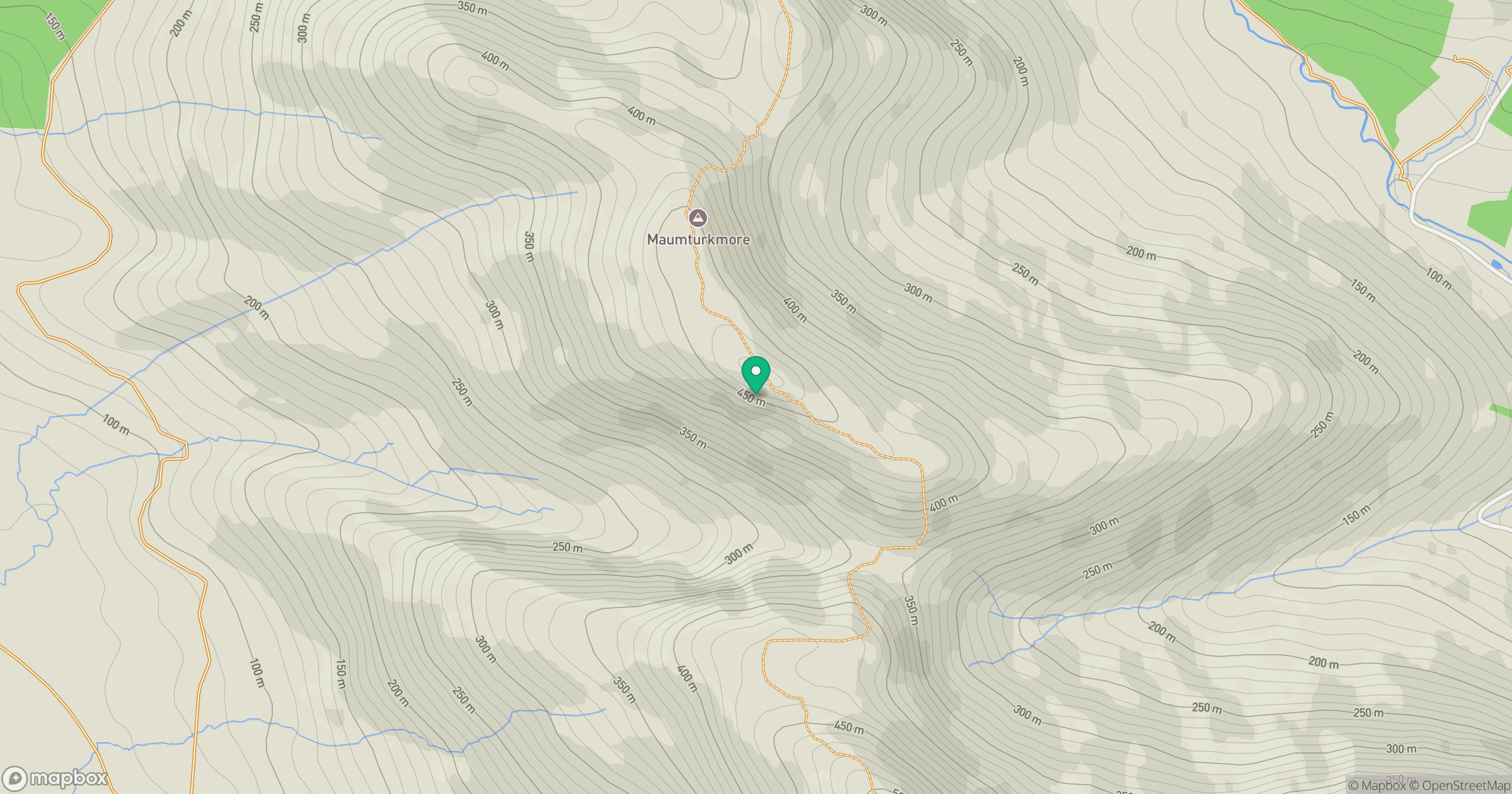
Grid reference: L855568
View on OpenStreetMapOpens a map in a new tab, centred on the hill.
Hills within 30 km
Straight-line distance, not a walking route or confirmation of access.
No comments yet. Be the first.